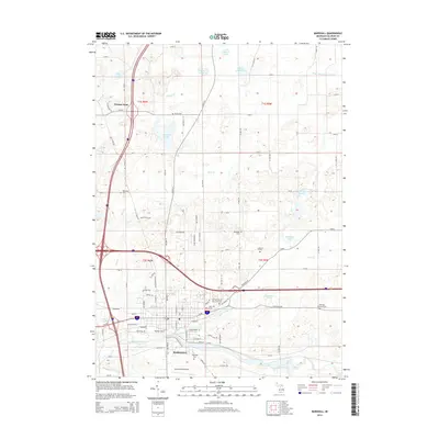
2014 Map of Marshall
USGS Topo · Published 2014About this map
The Kalamazoo River cuts a prominent path through this portion of south-central Michigan, defining the southern landscape near the city of Marshall. The river's influence is mirrored by the complex drainage systems of Rice Creek and Bear Creek, which feed into the main waterway amidst a terrain dotted with kettle lakes such as Lake of the Woods and Pardy Lake. This 2014 survey reveals a transition from the dense industrial and residential layout of the city, centered around Marshall Station, to the rural agricultural expanses of the surrounding townships.
Find a feature on this map
95 named features on this map. Tap any name to fly to it.
Don’t see what you’re looking for? This feature index may not catch every label — zoom into the map to look around manually.
Map Details
Editions of this 2014 Marshall Map
This is the sole edition of this map. No revisions or reprints were ever made.
Other maps of this area

1918 · Battle Creek
USGS Topo · 1:62,500

1918 · Union City
USGS Topo · 1:62,500

1921 · Marshall
USGS Topo · 1:62,500

1923 · Marshall
USGS Topo · 1:62,500

1943 · Battle Creek
USGS Topo · 1:62,500

1943 · Marshall
USGS Topo · 1:62,500

1947 · Bellevue
USGS Topo · 1:24,000

1947 · Ceresco
USGS Topo · 1:24,000

1947 · Union City
USGS Topo · 1:62,500

1948 · Homer
USGS Topo · 1:62,500