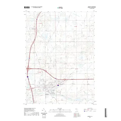
2019 Map of Marshall
USGS Topo · Published 2019About this map
Marshall serves as the focal point of this 2019 survey, situated where the Kalamazoo River and Rice Creek converge. The landscape is a complex network of wetland basins and small lakes, such as Potter Lake and Lake of the Woods, interspersed with a rigid grid of rural roads named by their distance in miles. For genealogists, the map is particularly dense with burial sites, including the Calhoun County Poor Farm Cem and Saint Marys Cem. Transportation infrastructure is a dominant feature, showing the intersection of major interstates and state highways that now bypass the older settlement patterns of the region. The southern edge of the city is marked by Brooks Field and Oakridge Cem, illustrating the modern balance of civic aviation and long-standing community landmarks.
Find a feature on this map
119 named features on this map. Tap any name to fly to it.
Don’t see what you’re looking for? This feature index may not catch every label — zoom into the map to look around manually.
Map Details
Editions of this 2019 Marshall Map
This is the sole edition of this map. No revisions or reprints were ever made.
Other maps of this area

1918 · Battle Creek
USGS Topo · 1:62,500

1918 · Union City
USGS Topo · 1:62,500

1921 · Marshall
USGS Topo · 1:62,500

1923 · Marshall
USGS Topo · 1:62,500

1943 · Battle Creek
USGS Topo · 1:62,500

1943 · Marshall
USGS Topo · 1:62,500

1947 · Bellevue
USGS Topo · 1:24,000

1947 · Ceresco
USGS Topo · 1:24,000

1947 · Union City
USGS Topo · 1:62,500

1948 · Homer
USGS Topo · 1:62,500