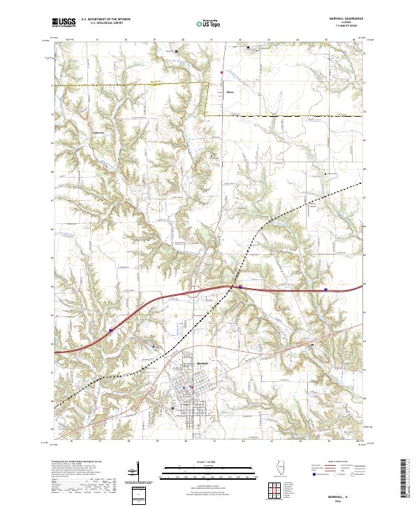
2024 Map of Marshall
USGS Topo · Published 2024About this map
The Clark County Courthouse serves as the focal point for the city of Marshall, situated along the historical corridor of the National Rd. This landscape is defined by the dendritic drainage patterns of Big Creek and its many tributaries, including West Fork Big Creek and East Fork Big Creek, which carve through the central Illinois plains. The map reveals a dense network of rural infrastructure, from the small community of Oliver in the north to the Castle Fin area in the west. Genealogists will find significant value in the distribution of family and community burial grounds scattered across the township, such as Quinn Cem, Asbury Cem, and Livingston Cem. The presence of the Lincoln Heritage Trl and the Kibler Airport highlights the intersection of historical transit routes and modern local aviation in this part of Clark County.
Find a feature on this map
134 named features on this map. Tap any name to fly to it.
Don’t see what you’re looking for? This feature index may not catch every label — zoom into the map to look around manually.
Map Details
Editions of this 2024 Marshall Map
This is the sole edition of this map. No revisions or reprints were ever made.
Other maps of this area

1932 · Marshall
USGS Topo · 1:62,500

1936 · Casey
USGS Topo · 1:48,000

1937 · Marshall
USGS Topo · 1:62,500

1942 · Hutton
USGS Topo · 1:24,000

1942 · Dennison
USGS Topo · 1:24,000

1942 · Casey
USGS Topo · 1:62,500

1943 · Casey
USGS Topo · 1:62,500

1946 · Kansas
USGS Topo · 1:62,500

1947 · Paris
USGS Topo · 1:62,500

1949 · Kansas
USGS Topo · 1:62,500