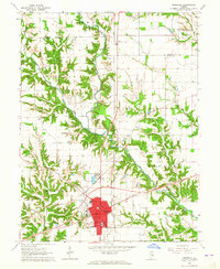
1964 Map of Marshall
USGS Topo · Published 1965About this map
Marshall serves as the central hub of this mid-1960s survey, where the New York Central railroad and major roadways like the Lincoln Heritage Trail intersect. The town's layout is well-defined, featuring several educational institutions such as North Side Sch, South Side Sch, and Ohio Sch, alongside a prominent Fairground on its western edge. Outside the main settlement, the landscape transitions into a mix of agricultural and industrial utility, evidenced by a Refinery and a Sewage Disposal plant.
Find a feature on this map
36 named features on this map. Tap any name to fly to it.
Don’t see what you’re looking for? This feature index may not catch every label — zoom into the map to look around manually.
Map Details
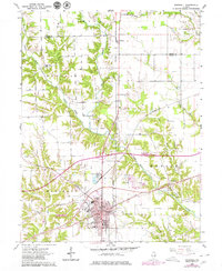
Editions of this 1964 Marshall Map
2 editions found
Other maps of this area

1932 · Marshall
USGS Topo · 1:62,500

1936 · Casey
USGS Topo · 1:48,000

1937 · Marshall
USGS Topo · 1:62,500

1942 · Hutton
USGS Topo · 1:24,000

1942 · Dennison
USGS Topo · 1:24,000

1942 · Casey
USGS Topo · 1:62,500

1943 · Casey
USGS Topo · 1:62,500

1946 · Kansas
USGS Topo · 1:62,500

1947 · Paris
USGS Topo · 1:62,500

1949 · Kansas
USGS Topo · 1:62,500