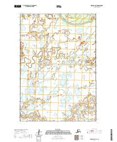
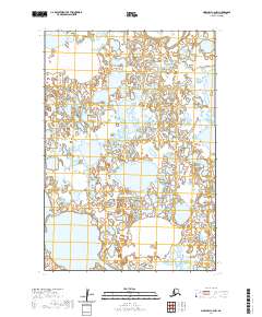
2020 Map of Marshall D-4 SE
USGS Topo · Published 2020About this map
The Kashunuk River meanders across this wetland landscape in the Kusilvak Census Area, defining a region where water and land are inextricably linked. The settlement of Kanapak sits near the center of the sheet, surrounded by an intricate network of smaller watercourses including Mankakuk Cr and Takonak Cr. In the southern portion of the quadrangle, the Pitmik River flows through the low-lying terrain, illustrating the hydrological complexity of the Yukon Delta region. The map provides a precise record of the various township and range boundaries, such as t20n r77w and t21n r76w, which segment this remote subarctic environment. The absence of roads or industrial infrastructure emphasizes the seasonal and water-dependent nature of life and travel in this part of Alaska as it was documented in 2020.
Find a feature on this map
11 named features on this map. Tap any name to fly to it.
Don’t see what you’re looking for? This feature index may not catch every label — zoom into the map to look around manually.
Map Details
Editions of this 2020 Marshall D-4 SE Map
This is the sole edition of this map. No revisions or reprints were ever made.
Other maps of this area

1951 · Marshall
USGS Topo · 1:250,000

1952 · Marshall D-4
USGS Topo · 1:63,360

1952 · Marshall D-3
USGS Topo · 1:63,360

1954 · Marshall C-3
USGS Topo · 1:63,360

1954 · Marshall C-4
USGS Topo · 1:63,360

1954 · Marshall
USGS Topo · 1:250,000
2020 · Marshall D-4 SW
USGS Topo · 1:25,000
2020 · Marshall D-4 NW
USGS Topo · 1:25,000
2020 · Marshall D-4 NE
USGS Topo · 1:25,000
2020 · Marshall C-4 NW
USGS Topo · 1:25,000