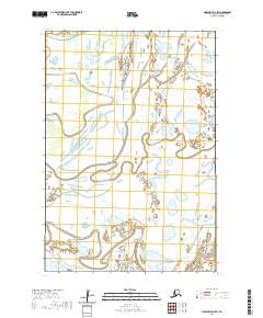
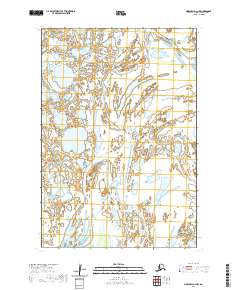
2020 Map of Marshall D-4 SW
USGS Topo · Published 2020About this map
Kwigorlak sits at the heart of this tundra landscape, where the meandering waterways of the Kashunuk River and its many tributaries define the geography. This 2020 survey of the Kusilvak Census Area reveals a complex network of wetlands and river channels characteristic of the Yukon-Kuskokwim Delta region. The north-south flow of Big River and the westward movement of the Nantok River create a shifting mosaic of water and land, showing a terrain that is largely undeveloped and dominated by natural processes. The presence of Pitmik River in the southern portion further illustrates the intricate drainage patterns found throughout the Marshall D-4 SW quadrangle, providing a modern record of the hydrologic shifts and topography in this remote Alaskan interior.
Find a feature on this map
11 named features on this map. Tap any name to fly to it.
Don’t see what you’re looking for? This feature index may not catch every label — zoom into the map to look around manually.
Map Details
Editions of this 2020 Marshall D-4 SW Map
This is the sole edition of this map. No revisions or reprints were ever made.
Other maps of this area

1951 · Marshall
USGS Topo · 1:250,000

1952 · Marshall D-5
USGS Topo · 1:63,360

1952 · Marshall D-4
USGS Topo · 1:63,360

1952 · Marshall C-5
USGS Topo · 1:63,360

1954 · Marshall C-4
USGS Topo · 1:63,360

1954 · Marshall
USGS Topo · 1:250,000
2020 · Marshall D-4 SE
USGS Topo · 1:25,000
2020 · Marshall D-5 SE
USGS Topo · 1:25,000
2020 · Marshall C-5 NE
USGS Topo · 1:25,000
2020 · Marshall D-4 NW
USGS Topo · 1:25,000