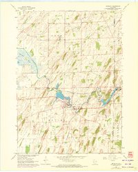
1962 Map of Marshall
USGS Topo · Published 1972About this map
The Maunesha River winds through the heart of the landscape, connecting the village of Marshall with the edges of Waterloo in this early 1960s Wisconsin survey. The area is defined by the heavy presence of the Chicago Milwaukee St Paul and Pacific railroad, which cuts through the wetland terrain of the Deansville Marsh. This rail corridor historically supported the small outposts and agricultural crossroads of York Center and Deansville, anchoring the rural economy of eastern Dane County.
Find a feature on this map
25 named features on this map. Tap any name to fly to it.
Don’t see what you’re looking for? This feature index may not catch every label — zoom into the map to look around manually.
Map Details
Editions of this 1962 Marshall Map
3 editions found
Other maps of this area

1890 · Sun Prairie
USGS Topo · 1:62,500

1891 · Waterloo
USGS Topo · 1:62,500

1894 · Waterloo
USGS Topo · 1:62,500

1896 · Sun Prairie
USGS Topo · 1:62,500

1905 · Sun Prairie
USGS Topo · 1:62,500

1907 · Sun Prairie
USGS Topo · 1:62,500

1910 · Waterloo
USGS Topo · 1:62,500

1955 · Columbus
USGS Topo · 1:62,500

1955 · Beaver Dam
USGS Topo · 1:62,500

1957 · Madison
USGS Topo · 1:250,000