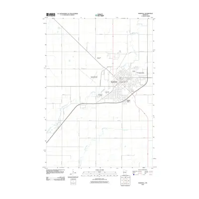
2010 Map of Marshall
USGS Topo · Published 2010About this map
The Redwood River meanders through the heart of Marshall, anchoring the city’s layout as it flows past the Lyon County Fairgrounds and the Redwood River Dam. This 2010 survey shows the community as a significant regional hub, clearly defined by the sprawling campus of Minnesota Southwest State University and the aviation infrastructure at Marshall Municipal Airport-Ryan Field. The transition from urban density to the surrounding agricultural grid is marked by several local burial grounds, including the Old Marshall Cemetery, Marshall Cemetery, and Calvary Cemetery, providing essential geographic anchors for genealogists. Public spaces like Garvin Park and Village Park offer a contrast to the industrial and academic zones, while Meadow Creek drains the southern prairies before meeting the primary river system.
Find a feature on this map
36 named features on this map. Tap any name to fly to it.
Don’t see what you’re looking for? This feature index may not catch every label — zoom into the map to look around manually.
Map Details
Editions of this 2010 Marshall Map
This is the sole edition of this map. No revisions or reprints were ever made.
Other maps of this area

1953 · New Ulm
USGS Topo · 1:250,000

1957 · New Ulm
USGS Topo · 1:250,000

1958 · New Ulm
USGS Topo · 1:250,000

1962 · Dudley
USGS Topo · 1:24,000

1962 · Cottonwood
USGS Topo · 1:24,000

1962 · Amiret
USGS Topo · 1:24,000

1963 · Russell
USGS Topo · 1:24,000

1963 · Lynd
USGS Topo · 1:24,000

1963 · Marshall SE
USGS Topo · 1:24,000

1963 · Marshall
USGS Topo · 1:24,000