
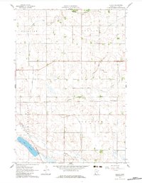
1962 Map of Dudley
USGS Topo · Published 1963About this map
Dudley sits at the center of this 1962 landscape, serving as a hub for the Chicago and North Western railroad during a period of intensive agricultural development. The terrain in this part of Lyon County is defined by a highly managed water system, with numerous man-made channels such as Judicial Ditch No 60 and Judicial Ditch No 91 redirecting the natural flow of the land into the Redwood River. These engineering efforts reflect the mid-century drive to maximize the tillable acreage of the fertile Minnesota prairie. To the southwest, Lake Marshall and the winding Meadow Creek offer a contrast to the geometric precision of the surrounding section lines and drainage networks. The presence of a local Gravel Pit suggests the ongoing maintenance of the rural road network that connects the townships of Fairview, Stanley, Clifton, and Lake Marshall.
Find a feature on this map
14 named features on this map. Tap any name to fly to it.
Don’t see what you’re looking for? This feature index may not catch every label — zoom into the map to look around manually.
Map Details
Editions of this 1962 Dudley Map
2 editions found
Other maps of this area

1953 · New Ulm
USGS Topo · 1:250,000

1957 · New Ulm
USGS Topo · 1:250,000

1958 · New Ulm
USGS Topo · 1:250,000

1962 · Cottonwood
USGS Topo · 1:24,000

1962 · School Grove Lake
USGS Topo · 1:24,000

1962 · Milroy SE
USGS Topo · 1:24,000

1962 · Amiret
USGS Topo · 1:24,000

1962 · Milroy
USGS Topo · 1:24,000

1963 · Marshall SE
USGS Topo · 1:24,000

1963 · Marshall
USGS Topo · 1:24,000