
1963 Map of Marshall SE
USGS Topo · Published 1964About this map
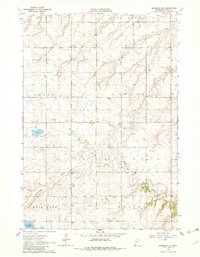
The Cottonwood River meanders across this rural landscape in southwestern Minnesota, defining the drainage patterns through the townships of Lyons, Sodus, Rock Lake, and Custer. This early 1960s survey records a predominantly agricultural region marked by dispersed farmsteads and organized by section lines. In the southwestern corner, Lake Yankton serves as a prominent landmark, with the Lakeside Cem situated nearby, providing a specific point of interest for genealogists tracing family roots in the area. Industrial activity is indicated by several Gravel Pits and a smaller Gravel Pit further north, reflecting the local extraction economy of the mid-20th century. The topography is characterized by a series of depressions and small water bodies that dot the prairie terrain between the river valleys.
Find a feature on this map
11 named features on this map. Tap any name to fly to it.
Don’t see what you’re looking for? This feature index may not catch every label — zoom into the map to look around manually.
Map Details
Editions of this 1963 Marshall SE Map
2 editions found
Other maps of this area

1953 · New Ulm
USGS Topo · 1:250,000

1957 · New Ulm
USGS Topo · 1:250,000

1958 · New Ulm
USGS Topo · 1:250,000

1962 · Dudley
USGS Topo · 1:24,000

1962 · Amiret
USGS Topo · 1:24,000

1963 · Russell
USGS Topo · 1:24,000

1963 · Lynd
USGS Topo · 1:24,000

1963 · Marshall
USGS Topo · 1:24,000

1967 · New Ulm
USGS Topo · 1:250,000

1967 · Balaton
USGS Topo · 1:24,000