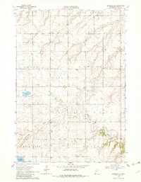
1963 Map of Marshall SE
USGS Topo · Published 1982About this map
The Cottonwood River meanders across this Lyon County landscape, which was primarily defined by the townships of Marshall, Sodus, Custer, and Rock Lake in the early 1960s. This agricultural region is punctuated by essential community landmarks such as Lakeside Cem, located near the southern margin. The presence of Gravel Pits and a Gravel Pit indicates the extraction of local glacial materials for road building and infrastructure development during this period of rural growth.
Find a feature on this map
11 named features on this map. Tap any name to fly to it.
Don’t see what you’re looking for? This feature index may not catch every label — zoom into the map to look around manually.
Map Details
Editions of this 1963 Marshall SE Map
2 editions found
Other maps of this area

1953 · New Ulm
USGS Topo · 1:250,000

1957 · New Ulm
USGS Topo · 1:250,000

1958 · New Ulm
USGS Topo · 1:250,000

1962 · Dudley
USGS Topo · 1:24,000

1962 · Amiret
USGS Topo · 1:24,000

1963 · Russell
USGS Topo · 1:24,000

1963 · Lynd
USGS Topo · 1:24,000

1963 · Marshall SE
USGS Topo · 1:24,000

1963 · Marshall
USGS Topo · 1:24,000

1967 · New Ulm
USGS Topo · 1:250,000