
1967 Map of Balaton
USGS Topo · Published 1968About this map
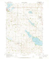
Lake Sarah and a series of prominent glacial lakes dominate this corner of the Minnesota prairie, where the Lyon and Murray County line divides a landscape of water and rail. The town of Balaton sits at the northwestern edge of the sheet, developed along the Chicago and North Western railroad corridor. This transportation spine also serves Garvin, connecting these prairie settlements to the wider regional economy. The map reveals a heavily managed hydrological environment, marked by County Ditch No 1 and County Ditch No 48, which illustrate the transformation of wetlands into productive farmland. Conservation efforts are well established by the late 1960s, evidenced by the presence of the Garvin State Wildlife Management Area and the Skandia State Wildlife Management Area, preserving tracts of native habitat amidst the surrounding townships of Rock Lake, Custer, and Skandia.
Find a feature on this map
20 named features on this map. Tap any name to fly to it.
Don’t see what you’re looking for? This feature index may not catch every label — zoom into the map to look around manually.
Map Details
Editions of this 1967 Balaton Map
2 editions found
Other maps of this area

1953 · New Ulm
USGS Topo · 1:250,000

1957 · New Ulm
USGS Topo · 1:250,000

1958 · New Ulm
USGS Topo · 1:250,000

1962 · Amiret
USGS Topo · 1:24,000

1963 · Russell
USGS Topo · 1:24,000

1963 · Marshall SE
USGS Topo · 1:24,000

1967 · New Ulm
USGS Topo · 1:250,000
1967 · Balaton SW
USGS Topo · 1:24,000

1967 · Hadley
USGS Topo · 1:24,000
1967 · Current Lake
USGS Topo · 1:24,000