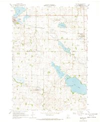
1967 Map of Balaton
USGS Topo · Published 1969About this map
Balaton and Garvin are the primary rail stops along the Chicago and North Western line in this late-1960s survey of the Lyon and Murray county border. The landscape is defined by its extensive prairie lakes and wetlands, dominated by Lake Sarah, Lake Maria, and Long Lake. This era shows a clear commitment to conservation with the establishment of large protected zones, including the Garvin State Wildlife Management Area and the Skandia State Wildlife Management Area.
Find a feature on this map
19 named features on this map. Tap any name to fly to it.
Don’t see what you’re looking for? This feature index may not catch every label — zoom into the map to look around manually.
Map Details
Editions of this 1967 Balaton Map
2 editions found
Other maps of this area

1953 · New Ulm
USGS Topo · 1:250,000

1957 · New Ulm
USGS Topo · 1:250,000

1958 · New Ulm
USGS Topo · 1:250,000

1962 · Amiret
USGS Topo · 1:24,000

1963 · Russell
USGS Topo · 1:24,000

1963 · Marshall SE
USGS Topo · 1:24,000

1967 · New Ulm
USGS Topo · 1:250,000

1967 · Balaton
USGS Topo · 1:24,000
1967 · Balaton SW
USGS Topo · 1:24,000

1967 · Hadley
USGS Topo · 1:24,000