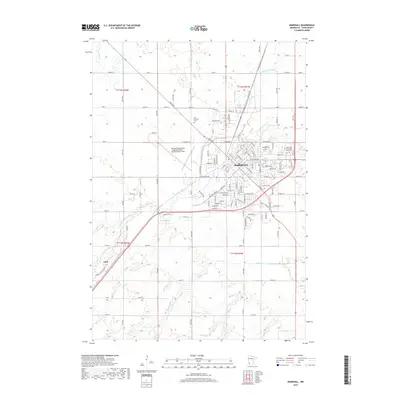
2019 Map of Marshall
USGS Topo · Published 2019About this map
The Redwood River winds through the heart of Marshall, providing a natural axis for this regional hub in Lyon County. The city's growth is anchored by the campus of Southwest Minnesota State Univ and the Southwest Minnesota Regional Airport - Marshall/Ryan Field, which define its northern and eastern peripheries. For those tracing family histories, three major burial grounds — Old Marshall Cem, Marshall Cem, and Calvary Cem — are clearly documented alongside the residential grid including W Main St and E College Dr. To the southwest, the smaller settlement of Lynd sits along the river's bend, connected by the local road network that includes Co Rd 74 and Co Rd 67. The map illustrates a landscape of organized agriculture and water management, where Meadow Cr and Threemile Cr feed into the primary river system.
Find a feature on this map
51 named features on this map. Tap any name to fly to it.
Don’t see what you’re looking for? This feature index may not catch every label — zoom into the map to look around manually.
Map Details
Editions of this 2019 Marshall Map
This is the sole edition of this map. No revisions or reprints were ever made.
Other maps of this area

1953 · New Ulm
USGS Topo · 1:250,000

1957 · New Ulm
USGS Topo · 1:250,000

1958 · New Ulm
USGS Topo · 1:250,000

1962 · Dudley
USGS Topo · 1:24,000

1962 · Cottonwood
USGS Topo · 1:24,000

1962 · Amiret
USGS Topo · 1:24,000

1963 · Russell
USGS Topo · 1:24,000

1963 · Lynd
USGS Topo · 1:24,000

1963 · Marshall SE
USGS Topo · 1:24,000

1963 · Marshall
USGS Topo · 1:24,000