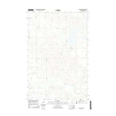
2014 Map of Marshall NW
USGS Topo · Published 2014About this map
The Knife River meanders across the southern portion of this landscape, joined by its tributary Deep Cr in the southwest corner. The terrain is characterized by the structured grid of rural section-line roads common to the North Dakota plains, including 12th St SW and 18th St SW. The area reflects a sparse, agricultural settlement pattern typical of the western edge of the Missouri Plateau. While no major towns are shown, the local transport network is anchored by corridors like Rodeo Rd W and north-south routes such as 94th Ave SW and 89th Ave SW. This topographic study by the U.S. Geological Survey provides a precise view of the drainage patterns and elevation changes across this portion of Dunn County.
Find a feature on this map
16 named features on this map. Tap any name to fly to it.
Don’t see what you’re looking for? This feature index may not catch every label — zoom into the map to look around manually.
Map Details
Editions of this 2014 Marshall NW Map
This is the sole edition of this map. No revisions or reprints were ever made.
Other maps of this area

1953 · Watford City
USGS Topo · 1:250,000

1957 · Watford City
USGS Topo · 1:250,000

1967 · Watford City
USGS Topo · 1:250,000

1973 · Marshall SE
USGS Topo · 1:24,000

1973 · Marshall SW
USGS Topo · 1:24,000

1973 · Ziner Butte
USGS Topo · 1:24,000
1973 · Hirschville
USGS Topo · 1:24,000

1973 · Halliday
USGS Topo · 1:24,000

1973 · Dunn Center
USGS Topo · 1:24,000

1973 · Werner
USGS Topo · 1:24,000