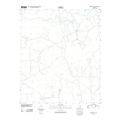
2010 Map of Marshall NW
USGS Topo · Published 2010About this map
Big Cypress Bayou and its winding tributaries define the topography of this Harrison County landscape as it appeared in the early 21st century. The map reveals a rural network of farm-to-market roads and local routes named for area families, such as St James Rd, Bertha Jackson Rd, and Jewell Gooch Rd. These family-named landmarks often cluster around local points of interest, including the Vickie Lynn Oil Field in the northeast.
Find a feature on this map
36 named features on this map. Tap any name to fly to it.
Don’t see what you’re looking for? This feature index may not catch every label — zoom into the map to look around manually.
Map Details
Editions of this 2010 Marshall NW Map
This is the sole edition of this map. No revisions or reprints were ever made.
Other maps of this area

1956 · Tyler
USGS Topo · 1:250,000

1961 · Hallsville
USGS Topo · 1:24,000

1961 · Lassater
USGS Topo · 1:24,000

1961 · Harleton
USGS Topo · 1:24,000

1962 · Kellyville
USGS Topo · 1:24,000

1962 · Marshall NW
USGS Topo · 1:24,000

1962 · Marshall West
USGS Topo · 1:24,000

1962 · Woodlawn
USGS Topo · 1:24,000

1962 · Jefferson
USGS Topo · 1:24,000

1962 · Marshall East
USGS Topo · 1:24,000