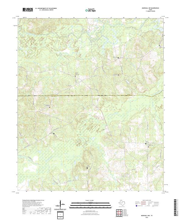
2022 Map of Marshall NW
USGS Topo · Published 2022About this map
Big Cypress Bayou and its winding tributaries define the borderlands between Marion and Harrison counties in East Texas. The landscape is heavily marked by small community hubs centered around country churches and family burial grounds, providing a detailed map of the region's genealogical history. Significant sites like New Zion Baptist Church and Hickory Grove Cem anchor the rural road network, while the wetlands of the Little Creek bottomlands reflect the natural drainage patterns of the Piney Woods. This 2022 survey captures the persistent rural character of the area northwest of Marshall, where long-established landmarks like Saint Marks Cem and Sherrill - Hamilton Cem remain preserved alongside modern thoroughfares like FM 3001.
Find a feature on this map
53 named features on this map. Tap any name to fly to it.
Don’t see what you’re looking for? This feature index may not catch every label — zoom into the map to look around manually.
Map Details
Editions of this 2022 Marshall NW Map
This is the sole edition of this map. No revisions or reprints were ever made.
Other maps of this area

1956 · Tyler
USGS Topo · 1:250,000

1961 · Hallsville
USGS Topo · 1:24,000

1961 · Lassater
USGS Topo · 1:24,000

1961 · Harleton
USGS Topo · 1:24,000

1962 · Kellyville
USGS Topo · 1:24,000

1962 · Marshall NW
USGS Topo · 1:24,000

1962 · Marshall West
USGS Topo · 1:24,000

1962 · Woodlawn
USGS Topo · 1:24,000

1962 · Jefferson
USGS Topo · 1:24,000

1962 · Marshall East
USGS Topo · 1:24,000