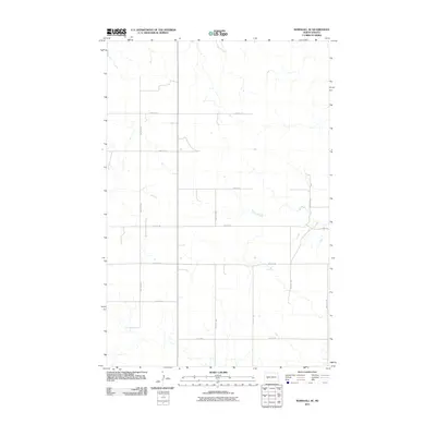
2011 Map of Marshall SE
USGS Topo · Published 2011About this map
Stark County's section-line road network defines the rural character of this landscape in the early twenty-first century. The grid is anchored by north-south corridors like 88th Ave SW and 84th Ave SW, which facilitate movement through a region shaped by agricultural parceling and the natural drainage patterns of intermittent streams. The map reveals the precise layout of local infrastructure, from 22nd St SW in the north to the curiously named 28 R St SW along the southern border. While the area lacks dense settlements, the geometric precision of routes such as 25th St SW and 27th St SW illustrates the persistent influence of the Public Land Survey System on North Dakota's modern development and land use.
Find a feature on this map
13 named features on this map. Tap any name to fly to it.
Don’t see what you’re looking for? This feature index may not catch every label — zoom into the map to look around manually.
Map Details
Editions of this 2011 Marshall SE Map
This is the sole edition of this map. No revisions or reprints were ever made.
Other maps of this area

1953 · Dickinson
USGS Topo · 1:250,000

1953 · Watford City
USGS Topo · 1:250,000

1957 · Dickinson
USGS Topo · 1:250,000

1957 · Watford City
USGS Topo · 1:250,000

1967 · Watford City
USGS Topo · 1:250,000

1973 · Marshall SE
USGS Topo · 1:24,000

1973 · Taylor
USGS Topo · 1:24,000

1973 · Willow Creek West
USGS Topo · 1:24,000

1973 · Schaffner Creek
USGS Topo · 1:24,000

1973 · Marshall SW
USGS Topo · 1:24,000