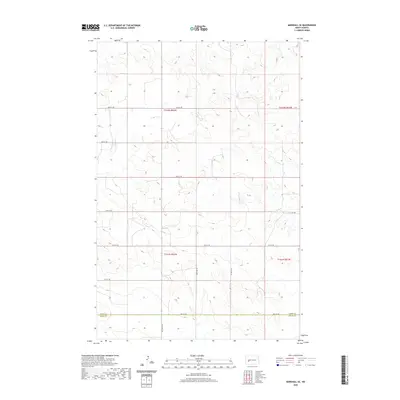
2020 Map of Marshall SE
USGS Topo · Published 2020About this map
The Dunn Co Stark Co boundary line divides this prairie landscape, where the rectangular survey system is clearly visible through a structured network of section lines and gravel roads. Located in western North Dakota, the terrain is defined by the high, rolling plains characteristic of the region. The map trace shows established rural infrastructure like 22nd St SW and 87th Ave SW, illustrating how the land has been partitioned for agriculture and ranching across T142N and T141N. Though largely devoid of concentrated settlements, the minor variations in elevation and the placement of local connectors like 25 1/4 St SW reveal the sparse but persistent human footprint on the North Dakota landscape during the early twenty-first century.
Find a feature on this map
16 named features on this map. Tap any name to fly to it.
Don’t see what you’re looking for? This feature index may not catch every label — zoom into the map to look around manually.
Map Details
Editions of this 2020 Marshall SE Map
This is the sole edition of this map. No revisions or reprints were ever made.
Other maps of this area

1953 · Dickinson
USGS Topo · 1:250,000

1953 · Watford City
USGS Topo · 1:250,000

1957 · Dickinson
USGS Topo · 1:250,000

1957 · Watford City
USGS Topo · 1:250,000

1967 · Watford City
USGS Topo · 1:250,000

1973 · Marshall SE
USGS Topo · 1:24,000

1973 · Taylor
USGS Topo · 1:24,000

1973 · Willow Creek West
USGS Topo · 1:24,000

1973 · Schaffner Creek
USGS Topo · 1:24,000

1973 · Marshall SW
USGS Topo · 1:24,000