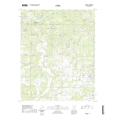
2020 Map of Marshall
USGS Topo · Published 2020About this map
The Searcy County Courthouse serves as the focal point for the city of Marshall, situated amidst the undulating landscape of the Ozarks. This modern survey illustrates the enduring patterns of rural Arkansas life, where small settlements like Gilbert and Zack remain connected by winding county roads and river valleys. The northern portion of the quadrangle is defined by the Buffalo National River, which snakes through deep bends such as Lane Bend and passes over fertile flats like Crane Bottom.
Find a feature on this map
153 named features on this map. Tap any name to fly to it.
Don’t see what you’re looking for? This feature index may not catch every label — zoom into the map to look around manually.
Map Details
Editions of this 2020 Marshall Map
This is the sole edition of this map. No revisions or reprints were ever made.
Other maps of this area

1892 · Marshall
USGS Topo · 1:125,000

1893 · Yellville
USGS Topo · 1:125,000

1894 · Marshall
USGS Topo · 1:125,000

1901 · Marshall
USGS Topo · 1:125,000

1903 · Yellville
USGS Topo · 1:125,000

1905 · Yellville
USGS Topo · 1:125,000

1929 · Yellville
USGS Topo · 1:125,000

1939 · Snowball
USGS Topo · 1:62,500

1941 · Snowball
USGS Topo · 1:62,500

1942 · Snowball
USGS Topo · 1:62,500