
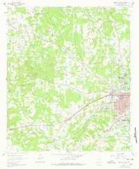
1962 Map of Marshall West
USGS Topo · Published 1963About this map
The western outskirts of Marshall during the early 1960s reveal a landscape shaped by education, industry, and the Texas and Pacific railroad. The campus of Wiley College and Austin Sch stand near the urban edge, while the surrounding countryside is dotted with rural institutions like the Green Star Sch and Grange Hall Sch. This transition from city to rural Harrison County is marked by a network of family-named cemeteries and community churches, including Macedonia Cem and Nesbitt Ch.
Find a feature on this map
47 named features on this map. Tap any name to fly to it.
Don’t see what you’re looking for? This feature index may not catch every label — zoom into the map to look around manually.
Map Details
Editions of this 1962 Marshall West Map
2 editions found
Other maps of this area

1956 · Tyler
USGS Topo · 1:250,000

1958 · Darco
USGS Topo · 1:62,500

1958 · Tatum
USGS Topo · 1:62,500

1961 · Hallsville
USGS Topo · 1:24,000

1961 · Harleton
USGS Topo · 1:24,000

1962 · Marshall NW
USGS Topo · 1:24,000

1962 · Woodlawn
USGS Topo · 1:24,000

1962 · Marshall East
USGS Topo · 1:24,000

1983 · Easton
USGS Topo · 1:24,000
1983 · Darco
USGS Topo · 1:24,000