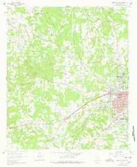
1962 Map of Marshall West
USGS Topo · Published 1978About this map
The western periphery of Marshall and the surrounding Harrison County countryside are defined by a network of rural schools, churches, and family burial grounds in the early 1960s. The landscape transitions from the urban grid of the city, featuring Wiley College and Lewis Hospital, to dispersed agricultural and resource-extraction areas like Pettit Field. The Missouri Pacific Railroad cuts through the southern reaches of the map, passing the settlement of Keokuk and crossing Potters Creek. This survey captures numerous community landmarks, including the Grange Hall Sch and Green Star Sch, alongside historical congregational centers like Springhill Ch and New Zion Ch. Industry is evident in the scattered Claypit and Borrow Pit operations, while the residential expansion of Marshall is visible along Crestview Dr and University Ave.
Find a feature on this map
61 named features on this map. Tap any name to fly to it.
Don’t see what you’re looking for? This feature index may not catch every label — zoom into the map to look around manually.
Map Details
Editions of this 1962 Marshall West Map
2 editions found
Other maps of this area

1956 · Tyler
USGS Topo · 1:250,000

1958 · Darco
USGS Topo · 1:62,500

1958 · Tatum
USGS Topo · 1:62,500

1961 · Hallsville
USGS Topo · 1:24,000

1961 · Harleton
USGS Topo · 1:24,000

1962 · Marshall NW
USGS Topo · 1:24,000

1962 · Marshall West
USGS Topo · 1:24,000

1962 · Woodlawn
USGS Topo · 1:24,000

1962 · Marshall East
USGS Topo · 1:24,000

1983 · Easton
USGS Topo · 1:24,000