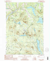
1986 Map of Marshfield
USGS Topo · Published 1987About this map
Groton State Forest dominates much of this mid-1980s terrain, where the rugged topography of the Green Mountains is defined by a dense network of high-altitude ponds and granite peaks. The Winooski River carves through the northwestern corner near the village of Marshfield, while a chain of significant water bodies including Mollys Falls Pond, Peacham Pond, and Lake Groton occupy the central and eastern uplands. The landscape is marked by substantial vertical relief, from the sharp face of Loveland Ledge to summits like Marshfield Mountain and Hardwood Mountain.
Find a feature on this map
64 named features on this map. Tap any name to fly to it.
Don’t see what you’re looking for? This feature index may not catch every label — zoom into the map to look around manually.
Map Details
Editions of this 1986 Marshfield Map
This is the sole edition of this map. No revisions or reprints were ever made.
Other maps of this area

1931 · Woodsville
USGS Topo · 1:48,000

1935 · Woodsville
USGS Topo · 1:62,500

1938 · St. Johnsbury
USGS Topo · 1:48,000

1939 · Plainfield
USGS Topo · 1:48,000

1940 · Plainfield
USGS Topo · 1:62,500

1941 · Woodsville
USGS Topo · 1:62,500

1943 · Plainfield
USGS Topo · 1:62,500

1943 · St. Johnsbury
USGS Topo · 1:62,500

1947 · Corinth
USGS Topo · 1:62,500

1948 · East Barre
USGS Topo · 1:62,500