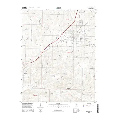
2015 Map of Marshfield
USGS Topo · Published 2015About this map
Marshfield sits at the heart of this Webster County landscape, where the BNSF Railway cuts a diagonal path through the terrain. This survey reveals a community deeply rooted in its local history, evidenced by a high density of rural burial grounds such as Welch Cemetery, Thomas Cemetery, and Osborn Cemetery that dot the countryside. The geography is defined by the headwaters of the Pomme de Terre River and the northern reaches of the James River, which are traversed at historic crossings like Bumgarden Ford and Lindstrew Ford. The transition from the town center to the peripheral settlements of Northview and Crown illustrates the region's enduring rural character. Genealogists will find particular value in the numerous family-named landmarks and the network of local roads including Big Timber Rd and Old Mill Rd that connect these historic sites.
Find a feature on this map
151 named features on this map. Tap any name to fly to it.
Don’t see what you’re looking for? This feature index may not catch every label — zoom into the map to look around manually.
Map Details
Editions of this 2015 Marshfield Map
This is the sole edition of this map. No revisions or reprints were ever made.
Other maps of this area

1884 · Springfield
USGS Topo · 1:125,000

1886 · Springfield
USGS Topo · 1:125,000

1937 · Ozark
USGS Topo · 1:48,000

1939 · Fordland
USGS Topo · 1:62,500

1942 · Fordland
USGS Topo · 1:62,500

1943 · Ozark
USGS Topo · 1:62,500

1945 · Ozark
USGS Topo · 1:62,500

1946 · Niangua
USGS Topo · 1:62,500

1947 · Strafford
USGS Topo · 1:62,500

1948 · Niangua
USGS Topo · 1:62,500