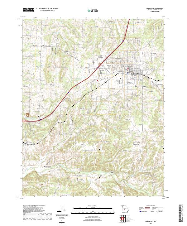
2021 Map of Marshfield
USGS Topo · Published 2021About this map
Marshfield serves as the primary hub in this Missouri landscape, where the headwaters of the Pomme de Terre River and the James River define the local drainage. The area is characterized by a high concentration of family and community burial grounds, including the Thomas Cem, Welch Cem, and Osborn Cem, providing essential markers for genealogical research. Transportation and water crossings are prominent, with Bumgarden Ford and Lindstrew Ford marking traditional river passage points. Smaller settlements like Northview and Crown anchor the outlying rural areas. The terrain is deeply etched by numerous named tributaries such as Turnbo Cr, Greer Cr, and Lacey Br, illustrating how the Ozark Plateau's topography influenced the placement of original homesteads and local road networks.
Find a feature on this map
151 named features on this map. Tap any name to fly to it.
Don’t see what you’re looking for? This feature index may not catch every label — zoom into the map to look around manually.
Map Details
Editions of this 2021 Marshfield Map
This is the sole edition of this map. No revisions or reprints were ever made.
Other maps of this area

1884 · Springfield
USGS Topo · 1:125,000

1886 · Springfield
USGS Topo · 1:125,000

1937 · Ozark
USGS Topo · 1:48,000

1939 · Fordland
USGS Topo · 1:62,500

1942 · Fordland
USGS Topo · 1:62,500

1943 · Ozark
USGS Topo · 1:62,500

1945 · Ozark
USGS Topo · 1:62,500

1946 · Niangua
USGS Topo · 1:62,500

1947 · Strafford
USGS Topo · 1:62,500

1948 · Niangua
USGS Topo · 1:62,500