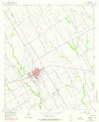
1956 Map of Mart
USGS Topo · Published 1978About this map
Mart serves as the focal point of this Central Texas landscape, situated at the intersection of McLennan and Falls counties. The town's grid is clearly defined, featuring local landmarks such as the Stadium and the Mart Cemetery. Surrounding the settlement, the terrain is characterized by a network of waterways including Big Creek, Cottonwood Creek, and Hogpen Creek, which delineate the agricultural and pastoral land.
Find a feature on this map
18 named features on this map. Tap any name to fly to it.
Don’t see what you’re looking for? This feature index may not catch every label — zoom into the map to look around manually.
Map Details
Editions of this 1956 Mart Map
2 editions found
Other maps of this area

1920 · Mart
USGS Topo · 1:62,500

1954 · Waco
USGS Topo · 1:250,000

1955 · Waco
USGS Topo · 1:250,000

1956 · Axtell
USGS Topo · 1:24,000

1956 · Mart
USGS Topo · 1:24,000

1957 · Prairie Hill
USGS Topo · 1:24,000

1957 · Groesbeck
USGS Topo · 1:62,500

1957 · Otto
USGS Topo · 1:24,000

1957 · Riesel
USGS Topo · 1:24,000
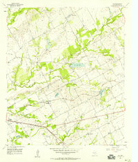
1957 · Elk
USGS Topo · 1:24,000