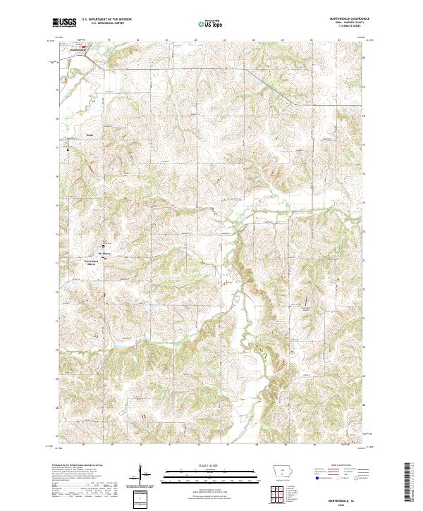
2022 Map of Martensdale
USGS Topo · Published 2022About this map
Martensdale and St. Marys anchor this agricultural landscape in Warren County, where the terrain is defined by a dense network of watercourses including the Middle River and the S River. The map reveals a transition from these primary river valleys to the smaller drainages of Painter Cr and Turkey Cr, creating a highly dissected upland area. This modern survey shows the persistence of small rural communities like Wick and the dual identity of West Saint Marys. Local landmarks such as the Saint Marys Cem and Wallace Cem provide valuable reference points for genealogists, while the presence of the Too Short Airport and Lake George suggests contemporary land uses alongside traditional farming blocks. The grid of roads, including Co Rd G50 and numerous named streets, illustrates the modern connectivity of this interior Iowa region.
Find a feature on this map
43 named features on this map. Tap any name to fly to it.
Don’t see what you’re looking for? This feature index may not catch every label — zoom into the map to look around manually.
Map Details
Editions of this 2022 Martensdale Map
This is the sole edition of this map. No revisions or reprints were ever made.
Other maps of this area

1931 · Indianola
USGS Topo · 1:62,500

1950 · New Virginia
USGS Topo · 1:62,500

1951 · Osceola
USGS Topo · 1:62,500

1951 · St. Charles
USGS Topo · 1:62,500

1952 · New Virginia
USGS Topo · 1:62,500

1954 · Des Moines
USGS Topo · 1:250,000

1956 · Des Moines
USGS Topo · 1:250,000

1957 · Des Moines
USGS Topo · 1:250,000

1969 · Des Moines
USGS Topo · 1:250,000
1972 · Scotch Ridge
USGS Topo · 1:24,000