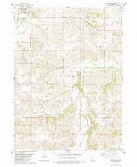
1983 Map of Martensdale
USGS Topo · Published 1984About this map
Martensdale serves as a central hub in this western Warren County landscape, situated at the confluence of several critical drainage systems and regional transport routes. The town is flanked by the Middle River and Clanton Creek, while the C & N W railroad line cuts through the northwestern corner near the Church of Christ. This 1980s-era documentation captures the township organization of Jefferson, Lincoln, Jackson, and White Oak, showing a well-established grid of rural avenues connecting small communities like St Marys and Wick. To the south, the terrain becomes more defined by the winding paths of the South River and Turkey Creek. Genealogists will find value in the location of the Wallace Cem and the Center Chapel, providing specific markers for family research in this agricultural heartland before modern rural development patterns significantly altered the local character.
Find a feature on this map
38 named features on this map. Tap any name to fly to it.
Don’t see what you’re looking for? This feature index may not catch every label — zoom into the map to look around manually.
Map Details
Editions of this 1983 Martensdale Map
This is the sole edition of this map. No revisions or reprints were ever made.
Other maps of this area

1931 · Indianola
USGS Topo · 1:62,500

1950 · New Virginia
USGS Topo · 1:62,500

1951 · Osceola
USGS Topo · 1:62,500

1951 · St. Charles
USGS Topo · 1:62,500

1952 · New Virginia
USGS Topo · 1:62,500

1954 · Des Moines
USGS Topo · 1:250,000

1956 · Des Moines
USGS Topo · 1:250,000

1957 · Des Moines
USGS Topo · 1:250,000

1969 · Des Moines
USGS Topo · 1:250,000
1972 · Scotch Ridge
USGS Topo · 1:24,000