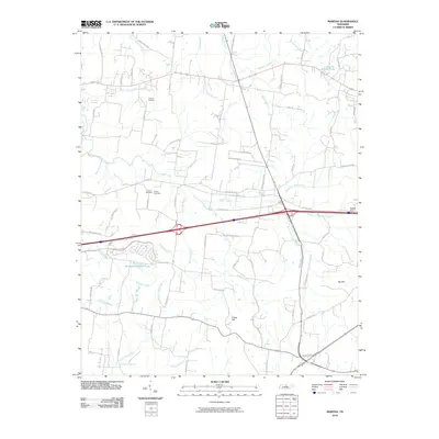
2010 Map of Martha
USGS Topo · Published 2010About this map
Viverett Cemetery and the adjacent Rutland Cemetery serve as anchors for local family histories in this part of Wilson County, just as suburban development began to reshape the landscape. The geography is defined by a dense web of waterways, including Cedar Creek, Stoners Creek, and Wilson Creek, which carve through the terrain near Posey Hill and Big Hill. This 2010 survey illustrates the transition from a purely rural drainage system to one punctuated by larger man-made features like Benjamin Franklin Lake and Prowell Lake.
Find a feature on this map
73 named features on this map. Tap any name to fly to it.
Don’t see what you’re looking for? This feature index may not catch every label — zoom into the map to look around manually.
Map Details
Editions of this 2010 Martha Map
This is the sole edition of this map. No revisions or reprints were ever made.
Other maps of this area

1903 · Nashville
USGS Topo · 1:125,000

1932 · Hermitage
USGS Topo · 1:62,500

1942 · Gallatin
USGS Topo · 1:100,000

1942 · Lebanon
USGS Topo · 1:100,000

1951 · Lebanon
USGS Topo · 1:24,000

1951 · Martha
USGS Topo · 1:24,000

1952 · Hendersonville
USGS Topo · 1:24,000

1952 · Hermitage
USGS Topo · 1:24,000

1952 · La Vergne
USGS Topo · 1:24,000

1955 · Laguardo
USGS Topo · 1:24,000