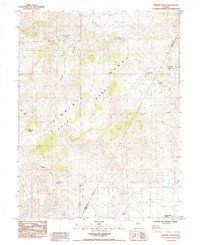
1985 Map of Martin Canyon
USGS Topo · Published 1985About this map
Mining heritage and rugged high-desert terrain define this mid-1980s survey of the Nevada landscape where the Virginia Range meets the Flowery Range. The map documents a significant history of extraction, most notably at the Ramsey (Site), where the Ramsey Comstock Mine and Ramsey Mine are located near San Juan Hill. To the west, the Gooseberry Mine and the Blackhawk Mine further illustrate the area's geological importance. Water sources are critical landmarks in this environment, with several reliable points recorded, including Biddleman Spring, Cooney Spring, and Blackhawk Spring. The boundary between Storey and Lyon Counties cuts diagonally across the southeastern portion of the map, passing through the foothills near the Blackhawk Canyon drainage system and the notable summit of Cinder Mountain.
Find a feature on this map
20 named features on this map. Tap any name to fly to it.
Don’t see what you’re looking for? This feature index may not catch every label — zoom into the map to look around manually.
Map Details
Editions of this 1985 Martin Canyon Map
2 editions found
Other maps of this area

1890 · Wadsworth
USGS Topo · 1:125,000

1891 · Carson
USGS Topo · 1:125,000

1891 · Wabuska
USGS Topo · 1:125,000

1891 · Reno
USGS Topo · 1:125,000

1892 · Wadsworth
USGS Topo · 1:125,000

1893 · Carson
USGS Topo · 1:125,000

1893 · Reno
USGS Topo · 1:125,000

1894 · Wadsworth
USGS Topo · 1:125,000

1894 · Wabuska
USGS Topo · 1:125,000

1950 · Virginia City
USGS Topo · 1:62,500