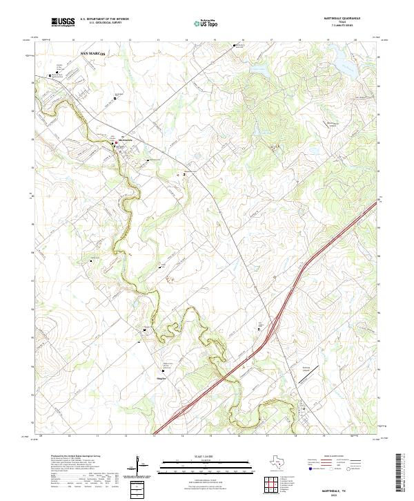
2022 Map of Martindale
USGS Topo · Published 2022About this map
The San Marcos River carves a winding path through the central Texas landscape, serving as the primary geographic corridor between the communities of Martindale and Staples. This modern survey documents the continued intersection of agriculture and residential growth along the Caldwell Co Guadalupe Co line. The area is dense with local genealogical sites, ranging from the Martindale City Cem to the Staples Cem African American, reflecting a long history of settlement along the riverbanks. Small tributaries like Morrison Cr and Dickerson Cr drain the surrounding fields into the San Marcos, while modern aviation is represented by private facilities like Roland Ranch Airport and Fentress Airpark. The map's layout highlights the transition from traditional river-bound town centers to expanding rural subdivisions like those found along Skyview Dr and River Lakes Ln.
Find a feature on this map
96 named features on this map. Tap any name to fly to it.
Don’t see what you’re looking for? This feature index may not catch every label — zoom into the map to look around manually.
Map Details
Editions of this 2022 Martindale Map
This is the sole edition of this map. No revisions or reprints were ever made.
Other maps of this area

1911 · San Marcos
USGS Topo · 1:125,000

1919 · San Marcos
USGS Topo · 1:125,000

1929 · Luling
USGS Topo · 1:62,500

1930 · Lockhart
USGS Topo · 1:62,500

1930 · Seguin
USGS Topo · 1:62,500

1953 · Seguin
USGS Topo · 1:250,000

1958 · Seguin
USGS Topo · 1:250,000

1963 · Lockhart North
USGS Topo · 1:24,000
1964 · Kingsbury
USGS Topo · 1:24,000
1964 · Martindale
USGS Topo · 1:24,000