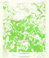
1964 Map of Kingsbury
USGS Topo · Published 1965About this map
Kingsbury serves as the focal point of this mid-1960s landscape, situated along the Southern Pacific railroad corridor where local life centered around the Kingsbury Cem and various rural industries. The terrain is defined by a dense network of waterways including York Creek, Brushy Creek, and the San Marcos River, which forms the boundary with Caldwell County. These watercourses dictated the placement of small agricultural communities and family-named landmarks.
Find a feature on this map
24 named features on this map. Tap any name to fly to it.
Don’t see what you’re looking for? This feature index may not catch every label — zoom into the map to look around manually.
Map Details
Editions of this 1964 Kingsbury Map
Other maps of this area

1911 · San Marcos
USGS Topo · 1:125,000

1919 · San Marcos
USGS Topo · 1:125,000

1924 · San Marcos 3-c
USGS Topo · 1:48,000

1924 · San Marcos 3-d
USGS Topo · 1:48,000

1925 · San Marcos 4-c
USGS Topo · 1:48,000

1929 · Luling
USGS Topo · 1:62,500

1930 · Lockhart
USGS Topo · 1:62,500

1930 · Seguin
USGS Topo · 1:62,500

1953 · Seguin
USGS Topo · 1:250,000

1958 · Seguin
USGS Topo · 1:250,000