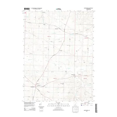
2013 Map of Martinsburg
USGS Topo · Published 2013About this map
Martinsburg and Bladensburg anchor the southern portion of this landscape, where the road network converges near the banks of Wakatomika Cr. The area is defined by a dense concentration of family farms and local institutions, including Veatch Farms, Lepley Farms, and the Dugan Stock Farm. Genealogists will find significant value in the numerous burial grounds documented, such as the Martinsburg Methodist Episcopal Cem and the Kemmerer Cem. A notable engineering landmark, the Mill Road Bowstring Bridge, spans Tomaky Br north of Martinsburg.
Find a feature on this map
94 named features on this map. Tap any name to fly to it.
Don’t see what you’re looking for? This feature index may not catch every label — zoom into the map to look around manually.
Map Details
Editions of this 2013 Martinsburg Map
This is the sole edition of this map. No revisions or reprints were ever made.
Other maps of this area

1909 · Newark
USGS Topo · 1:62,500

1910 · Frazeysburg
USGS Topo · 1:62,500

1912 · Gambier
USGS Topo · 1:62,500

1913 · Brinkhaven
USGS Topo · 1:62,500

1914 · Gambier
USGS Topo · 1:62,500

1915 · Brinkhaven
USGS Topo · 1:62,500

1943 · Gambier
USGS Topo · 1:62,500

1950 · Marion
USGS Topo · 1:250,000
1961 · Mt Vernon
USGS Topo · 1:24,000
1961 · Utica
USGS Topo · 1:24,000