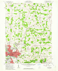
1961 Map of Mt Vernon
USGS Topo · Published 1962About this map
The Kokosing River defines the southern landscape of this mid-century survey, winding through a region characterized by academic institutions and social infrastructure. The city of Mt Vernon serves as the central hub, surrounded by distinct neighborhoods like North Mt Vernon and South Mt Vernon. Notable institutional footprints include the expansive Mt Vernon State Hospital and the nearby County Home, while the village of Gambier is anchored by the College campus to the southeast.
Find a feature on this map
57 named features on this map. Tap any name to fly to it.
Don’t see what you’re looking for? This feature index may not catch every label — zoom into the map to look around manually.
Map Details
Editions of this 1961 Mt Vernon Map
4 editions found
Other maps of this area

1912 · Gambier
USGS Topo · 1:62,500

1912 · Perrysville
USGS Topo · 1:62,500

1914 · Gambier
USGS Topo · 1:62,500

1915 · Perrysville
USGS Topo · 1:62,500

1915 · Shauck
USGS Topo · 1:62,500

1915 · Fredericktown
USGS Topo · 1:62,500

1943 · Shauck
USGS Topo · 1:62,500

1943 · Gambier
USGS Topo · 1:62,500

1943 · Fredericktown
USGS Topo · 1:62,500

1944 · Perrysville
USGS Topo · 1:62,500