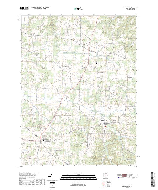
2023 Map of Martinsburg
USGS Topo · Published 2023About this map
Martinsburg and Bladensburg anchor this Knox County landscape, where the terrain is carved by the Wakatomika Creek and its many tributaries. The area is dense with family and community history, evidenced by numerous burial grounds including Grove Cem, Bethel Cem, and the Kemmerer Cem. The rural character of the region is defined by a dense network of country roads such as Newcastle Rd and Millersburg Rd that connect the small settlements of Pipesville to the surrounding hills and valleys. Natural features like Arbutus Glen and the Kokosing River in the northwest corner suggest a landscape of significant relief, where water drainage through Dudgeon Ditch and Harrod Run has historically influenced local land use and boundary lines. Genealogists will find particular value in the distinct church-affiliated cemeteries, such as the Martinsburg Presbyterian Cem and Martinsburg Methodist Episcopal Cem, which mark the spiritual and social centers of the early community.
Find a feature on this map
73 named features on this map. Tap any name to fly to it.
Don’t see what you’re looking for? This feature index may not catch every label — zoom into the map to look around manually.
Map Details
Editions of this 2023 Martinsburg Map
This is the sole edition of this map. No revisions or reprints were ever made.
Other maps of this area

1909 · Newark
USGS Topo · 1:62,500

1910 · Frazeysburg
USGS Topo · 1:62,500

1912 · Gambier
USGS Topo · 1:62,500

1913 · Brinkhaven
USGS Topo · 1:62,500

1914 · Gambier
USGS Topo · 1:62,500

1915 · Brinkhaven
USGS Topo · 1:62,500

1943 · Gambier
USGS Topo · 1:62,500

1950 · Marion
USGS Topo · 1:250,000
1961 · Mt Vernon
USGS Topo · 1:24,000
1961 · Utica
USGS Topo · 1:24,000