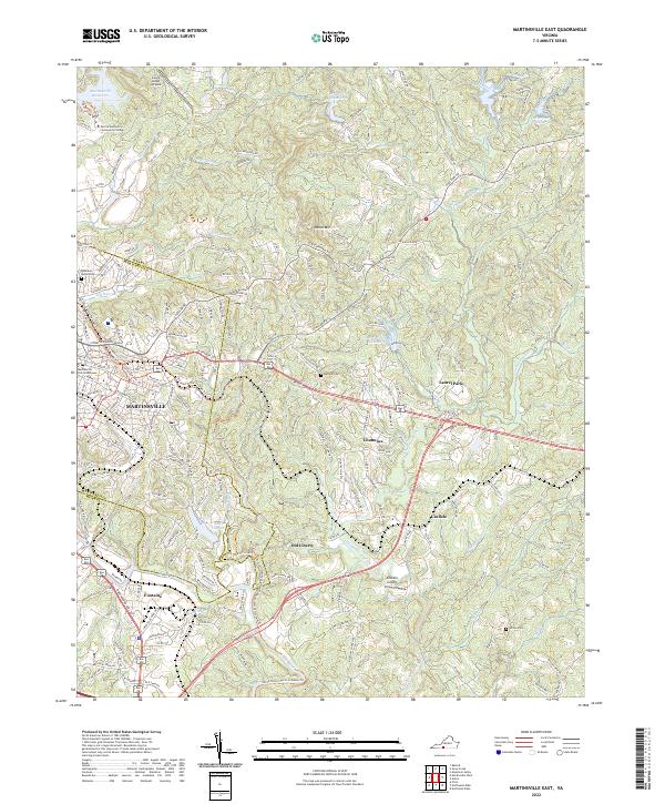
2022 Map of Martinsville East
USGS Topo · Published 2022About this map
Martinsville serves as the regional hub in this 2022 survey, where the Martinsville City Courthouse anchors the downtown district. The landscape transitions from the urban core to developed suburban pockets like Chatmoss and Laurel Park, while the Smith River winds along the southern edge of the quadrangle. Significant educational and transport infrastructure is evident, including the campus of Patrick and Henry Community College and local aviation sites such as Loury Lester Airpark and Gravely Airport.
Find a feature on this map
44 named features on this map. Tap any name to fly to it.
Don’t see what you’re looking for? This feature index may not catch every label — zoom into the map to look around manually.
Map Details
Editions of this 2022 Martinsville East Map
This is the sole edition of this map. No revisions or reprints were ever made.
Other maps of this area

1922 · Callands
USGS Topo · 1:48,000

1924 · Martinsville
USGS Topo · 1:48,000

1924 · Draper
USGS Topo · 1:48,000

1924 · Callands
USGS Topo · 1:62,500

1925 · Rocky Mount
USGS Topo · 1:48,000

1926 · Martinsville
USGS Topo · 1:62,500

1926 · Draper
USGS Topo · 1:62,500

1927 · Rocky Mount
USGS Topo · 1:62,500

1927 · Martinsville
USGS Topo · 1:62,500

1944 · Martinsville
USGS Topo · 1:62,500