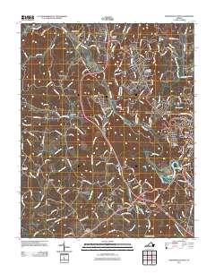
2011 Map of Martinsville West
USGS Topo · Published 2011About this map
The Smith River winds through the heart of Henry County, carving a path through the foothills and shaping the development of Martinsville and its surrounding communities. This 2011 survey captures the suburban and industrial landscape west of the city center, where historic textile towns like Fieldale and Stanleytown remain anchored to the river valley. The map reveals the intricate water network feeding the Smith, including Jordan Creek, Beaver Creek, and Reed Creek, which define the local drainage patterns around Collinsville and Bassett Forks.
Find a feature on this map
161 named features on this map. Tap any name to fly to it.
Don’t see what you’re looking for? This feature index may not catch every label — zoom into the map to look around manually.
Map Details
Editions of this 2011 Martinsville West Map
This is the sole edition of this map. No revisions or reprints were ever made.
Other maps of this area

1924 · Martinsville
USGS Topo · 1:48,000

1925 · Rocky Mount
USGS Topo · 1:48,000

1926 · Martinsville
USGS Topo · 1:62,500

1926 · Critz
USGS Topo · 1:48,000

1927 · Rocky Mount
USGS Topo · 1:62,500

1927 · Martinsville
USGS Topo · 1:62,500

1928 · Critz
USGS Topo · 1:62,500

1944 · Martinsville
USGS Topo · 1:62,500

1944 · Rocky Mount
USGS Topo · 1:62,500

1953 · Winston-Salem
USGS Topo · 1:250,000