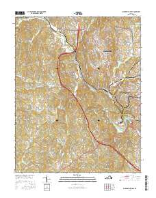
2016 Map of Martinsville West
USGS Topo · Published 2016About this map
Martinsville and its industrial corridor along the Smith River anchor this 2016 study of Henry County. The map details the transition from the denser street grids of the county seat to the outlying textile and manufacturing communities of Fieldale and Bassett Forks. Significant institutional landmarks are recorded, including the New Coll Institute and the American National Univ Martinsville Campus, alongside major burial grounds like Roselawn Burial Park and Oakwood Cem. The southern and western reaches of the quadrangle reveal a more dispersed settlement pattern, with rural names such as Horse Pasture and Preston situated among a network of small waterways including Grassy Creek and Tanyard Branch. These features reflect the long-standing geographic identity of a region shaped by both its river-driven industry and its upland terrain, capped by landmarks like Chestnut Knob and Dug Mountain.
Find a feature on this map
225 named features on this map. Tap any name to fly to it.
Don’t see what you’re looking for? This feature index may not catch every label — zoom into the map to look around manually.
Map Details
Editions of this 2016 Martinsville West Map
This is the sole edition of this map. No revisions or reprints were ever made.
Other maps of this area

1924 · Martinsville
USGS Topo · 1:48,000

1925 · Rocky Mount
USGS Topo · 1:48,000

1926 · Martinsville
USGS Topo · 1:62,500

1926 · Critz
USGS Topo · 1:48,000

1927 · Rocky Mount
USGS Topo · 1:62,500

1927 · Martinsville
USGS Topo · 1:62,500

1928 · Critz
USGS Topo · 1:62,500

1944 · Martinsville
USGS Topo · 1:62,500

1944 · Rocky Mount
USGS Topo · 1:62,500

1953 · Winston-Salem
USGS Topo · 1:250,000