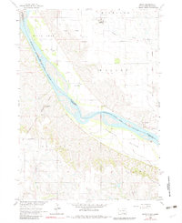
1964 Map of Marty
USGS Topo · Published 1982About this map
The Missouri River serves as the central artery and state line in this mid-1960s survey, dividing South Dakota and Nebraska while defining a landscape steeped in tribal and military history. The Yankton Indian Res Bdy and the Old Indian Treaty Boundary intersect the terrain, reflecting the complex historical land divisions of the region. The settlement of Marty stands in the north, while Greenwood sits further downriver, both serving as focal points for the local community near the river's edge.
Find a feature on this map
23 named features on this map. Tap any name to fly to it.
Don’t see what you’re looking for? This feature index may not catch every label — zoom into the map to look around manually.
Map Details
Editions of this 1964 Marty Map
2 editions found
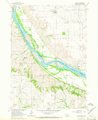
Other maps of this area

1950 · Lynch
USGS Topo · 1:24,000

1950 · Monowi
USGS Topo · 1:24,000

1951 · Bristow
USGS Topo · 1:24,000

1952 · Monowi
USGS Topo · 1:24,000

1955 · Mitchell
USGS Topo · 1:250,000

1955 · O'Neill
USGS Topo · 1:250,000

1959 · O'Neill
USGS Topo · 1:250,000

1959 · Mitchell
USGS Topo · 1:250,000

1964 · Fort Randall Dam
USGS Topo · 1:24,000

1964 · Gross
USGS Topo · 1:24,000