
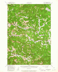
1957 Map of Marys Peak
USGS Topo · Published 1958About this map
Marys Peak towers over this mid-century landscape, a high point marking the convergence of the Siuslaw National Forest and the Corvallis Watershed. The terrain is defined by the headwaters of the Luckiamute River and Marys River, where small timber and mountain communities like Nashville, Summit, and Burnt Woods are linked by the Southern Pacific railroad and Highway 20. The map records essential infrastructure of the era, from the Big Elk Guard Station and a Microwave Relay to the Oregon State Fish Hatchery.
Find a feature on this map
47 named features on this map. Tap any name to fly to it.
Don’t see what you’re looking for? This feature index may not catch every label — zoom into the map to look around manually.
Map Details
Editions of this 1957 Marys Peak Map
2 editions found
Other maps of this area

1921 · Corvallis
USGS Topo · 1:62,500

1922 · Monroe
USGS Topo · 1:62,500

1939 · Marys Peak
USGS Topo · 1:62,500

1939 · Monroe
USGS Topo · 1:62,500

1942 · Euchre Mtn
USGS Topo · 1:62,500

1942 · Marys Peak
USGS Topo · 1:62,500

1942 · Alsea
USGS Topo · 1:62,500

1942 · Monroe
USGS Topo · 1:62,500

1942 · Corvallis
USGS Topo · 1:62,500

1942 · Valsetz
USGS Topo · 1:62,500