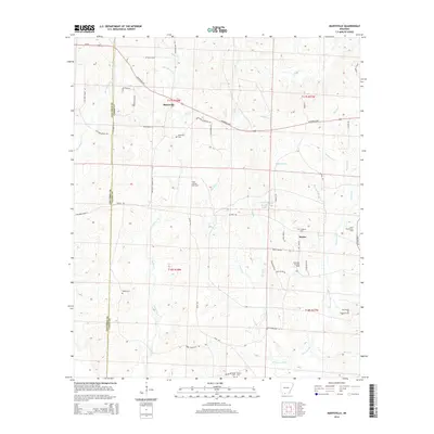
2014 Map of Marysville
USGS Topo · Published 2014About this map
Wilks Oil and Gas Field and the Shuler Oil and Gas Field define the economic character of this landscape in western Union County. This territory, spanning the border with Columbia County, is marked by a complex network of resource extraction roads like Tram Rd and Deer Camp Rd. The settlement of Marysville sits in the northern portion of the map, served by the Magnolia Hwy and Us-82. The southern area is dominated by the hydrology of Three Creeks and its various tributaries, including Slow Motion Cr and Garner Cr. Family and community history is preserved through numerous rural burial grounds, such as Babbs Cem and the Fredonia Cem near Shuler. The presence of the Cairo Oil and Gas Field further illustrates the continued industrial importance of the region's petroleum resources.
Find a feature on this map
61 named features on this map. Tap any name to fly to it.
Don’t see what you’re looking for? This feature index may not catch every label — zoom into the map to look around manually.
Map Details
Editions of this 2014 Marysville Map
This is the sole edition of this map. No revisions or reprints were ever made.
Other maps of this area

1953 · El Dorado
USGS Topo · 1:250,000

1957 · El Dorado
USGS Topo · 1:250,000

1958 · El Dorado
USGS Topo · 1:250,000

1960 · El Dorado
USGS Topo · 1:250,000

1962 · Lisbon
USGS Topo · 1:24,000

1962 · Mt Holly
USGS Topo · 1:24,000

1964 · Louann
USGS Topo · 1:62,500

1966 · Village
USGS Topo · 1:24,000

1966 · Spotville
USGS Topo · 1:24,000
1971 · Wesson
USGS Topo · 1:24,000