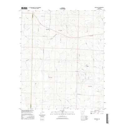
2017 Map of Marysville
USGS Topo · Published 2017About this map
The borderlands of Columbia and Union Counties are defined by a network of drainage creeks and timberland, centered on the historic settlements of Marysville and Shuler. The landscape is etched with the paths of Slow Motion Creek, Sewell Creek, and the headwaters of Three Creeks, which dictated early movement through these wooded bottomlands. Genealogists can find significant local markers in the form of several family and community burial grounds, including Marysville Cemetery and the more remote Babbs Cemetery to the west.
Find a feature on this map
54 named features on this map. Tap any name to fly to it.
Don’t see what you’re looking for? This feature index may not catch every label — zoom into the map to look around manually.
Map Details
Editions of this 2017 Marysville Map
This is the sole edition of this map. No revisions or reprints were ever made.
Other maps of this area

1953 · El Dorado
USGS Topo · 1:250,000

1957 · El Dorado
USGS Topo · 1:250,000

1958 · El Dorado
USGS Topo · 1:250,000

1960 · El Dorado
USGS Topo · 1:250,000

1962 · Lisbon
USGS Topo · 1:24,000

1962 · Mt Holly
USGS Topo · 1:24,000

1964 · Louann
USGS Topo · 1:62,500

1966 · Village
USGS Topo · 1:24,000

1966 · Spotville
USGS Topo · 1:24,000
1971 · Wesson
USGS Topo · 1:24,000