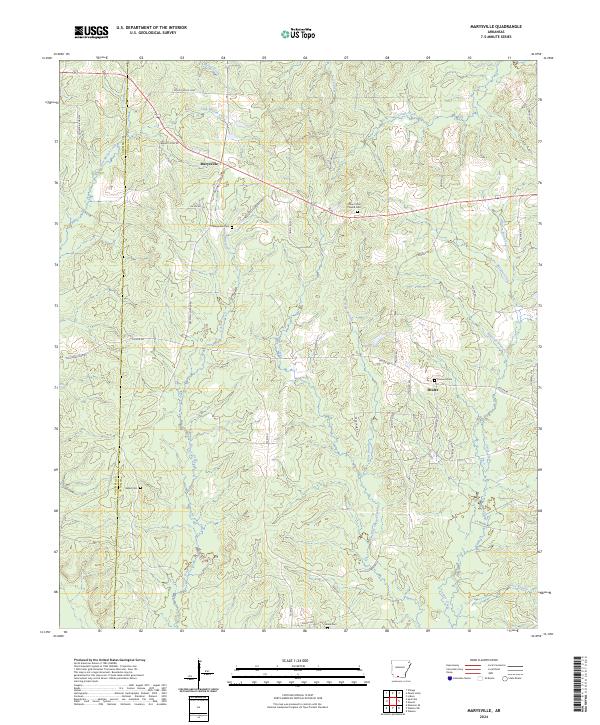
2024 Map of Marysville
USGS Topo · Published 2024About this map
Marysville and Shuler anchor this portion of Union County, reflecting a landscape defined by small settlements and the winding waterways of the West Arkansas timberlands. The terrain is deeply etched by a network of drainage systems, including Three Creeks, Slow Motion Creek, and Mill Creek. These watercourses historically dictated the placement of early roads and homesteads, many of which are marked today by family and community landmarks. Genealogists will find several significant burial sites, such as Marysville Cem and Fredonia Cem, alongside rural spiritual centers like Mount Sinai Church. The map also captures several local throughways like Mount Holly Loop and Barney Giles Rd, which follow the subtle ridgelines between the creeks, illustrating the enduring transport patterns of this rural South Arkansas region.
Find a feature on this map
53 named features on this map. Tap any name to fly to it.
Don’t see what you’re looking for? This feature index may not catch every label — zoom into the map to look around manually.
Map Details
Editions of this 2024 Marysville Map
This is the sole edition of this map. No revisions or reprints were ever made.
Other maps of this area

1953 · El Dorado
USGS Topo · 1:250,000

1957 · El Dorado
USGS Topo · 1:250,000

1958 · El Dorado
USGS Topo · 1:250,000

1960 · El Dorado
USGS Topo · 1:250,000

1962 · Lisbon
USGS Topo · 1:24,000

1962 · Mt Holly
USGS Topo · 1:24,000

1964 · Louann
USGS Topo · 1:62,500

1966 · Village
USGS Topo · 1:24,000

1966 · Spotville
USGS Topo · 1:24,000
1971 · Wesson
USGS Topo · 1:24,000