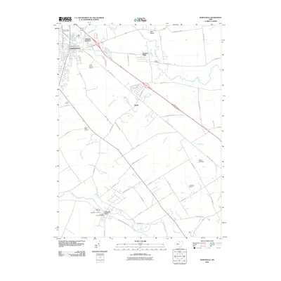
2010 Map of Marysville
USGS Topo · Published 2010About this map
Marysville serves as the primary hub of this Central Ohio landscape, where residential expansion is visible in developments like Millcreek Meadows. The township is defined by its agricultural foundations and the drainage of Mill Creek and Big Darby Creek, with several small settlements such as New Dover and Dipple scattered across the rural grid. Industrial activity is concentrated along the Industrial Pkwy corridor, contrasting with the preservation of local heritage seen in the numerous burial grounds, including Trinity Cemetery and Buxton Cemetery. Genealogists may find interest in the distinct Old Darby Cemetery and New Darby Cemetery near the southern settlement of Unionville Center. The presence of the Union County Fairgrounds and the Union County Airport near the town center highlights the area's role as a civic and transportation focal point for the surrounding farmland.
Find a feature on this map
55 named features on this map. Tap any name to fly to it.
Don’t see what you’re looking for? This feature index may not catch every label — zoom into the map to look around manually.
Map Details
Editions of this 2010 Marysville Map
This is the sole edition of this map. No revisions or reprints were ever made.
Other maps of this area

1901 · Dublin
USGS Topo · 1:62,500

1903 · Dublin
USGS Topo · 1:62,500

1913 · Richwood
USGS Topo · 1:62,500

1915 · Richwood
USGS Topo · 1:62,500

1916 · Milford Center
USGS Topo · 1:62,500

1924 · Delaware
USGS Topo · 1:62,500

1925 · Delaware
USGS Topo · 1:62,500

1944 · Richwood
USGS Topo · 1:62,500

1944 · Milford Center
USGS Topo · 1:62,500

1944 · Delaware
USGS Topo · 1:62,500