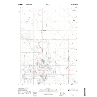
2018 Map of Mason City
USGS Topo · Published 2018About this map
The Winnebago River meanders through the heart of Mason City, defining the urban and natural geography of this northern Iowa landscape. The river's influence is evident in the numerous crossings that connect the city, including the State Street Bridge and the Meredith Willson Music Man Footbridge. Beyond the industrial and residential core, the map reveals a network of cemeteries such as Elmwood-Saint Joseph Municipal Cem and Fellows Cem, which serve as vital landmarks for local genealogical research. Northward, the terrain opens into agricultural lands and smaller settlements like Freeman and Plymouth, where the Plymouth Junction railroad crossing indicates the area's historical reliance on rail transport. The presence of Harris Field and several small lakes like Spring Lake underscores the mix of utility and recreation in the Cerro Gordo County countryside.
Find a feature on this map
112 named features on this map. Tap any name to fly to it.
Don’t see what you’re looking for? This feature index may not catch every label — zoom into the map to look around manually.
Map Details
Editions of this 2018 Mason City Map
This is the sole edition of this map. No revisions or reprints were ever made.
Other maps of this area

1954 · Mason City
USGS Topo · 1:250,000

1957 · Mason City
USGS Topo · 1:250,000

1958 · Mason City
USGS Topo · 1:250,000

1959 · Mason City
USGS Topo · 1:24,000

1959 · Mason City
USGS Topo · 1:62,500

1959 · Nora Springs
USGS Topo · 1:24,000

1959 · Mason City SE
USGS Topo · 1:24,000

1959 · Hanford
USGS Topo · 1:24,000

1972 · Manly
USGS Topo · 1:24,000

1972 · Burchinal
USGS Topo · 1:24,000