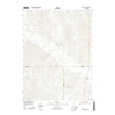
2014 Map of Mason City SW
USGS Topo · Published 2014About this map
Cumro sits at the northwestern edge of this landscape where the undulating hills of central Nebraska meet the wide drainage basin of the South Loup River. The area is defined by a dense network of seasonal and perennial waterways, including Box Elder Cr, Kilgore Cr, and Sand Cr, which have carved distinct topographical features like Flat Bottom and Wild Horse Valley. This survey captures the rural infrastructure of the region, where a grid of section roads connects isolated agricultural sites and community landmarks such as the Box Elder Cem.
Find a feature on this map
30 named features on this map. Tap any name to fly to it.
Don’t see what you’re looking for? This feature index may not catch every label — zoom into the map to look around manually.
Map Details
Editions of this 2014 Mason City SW Map
This is the sole edition of this map. No revisions or reprints were ever made.
Other maps of this area

1896 · Lexington
USGS Topo · 1:125,000

1896 · Kearney
USGS Topo · 1:125,000

1899 · Lexington
USGS Topo · 1:125,000

1951 · Eddyville NE
USGS Topo · 1:24,000

1951 · Mason City SW
USGS Topo · 1:24,000

1951 · Eddyville
USGS Topo · 1:24,000

1951 · Mason City NW
USGS Topo · 1:24,000

1951 · Mason City
USGS Topo · 1:24,000

1951 · Mason City SE
USGS Topo · 1:24,000

1955 · Broken Bow
USGS Topo · 1:250,000