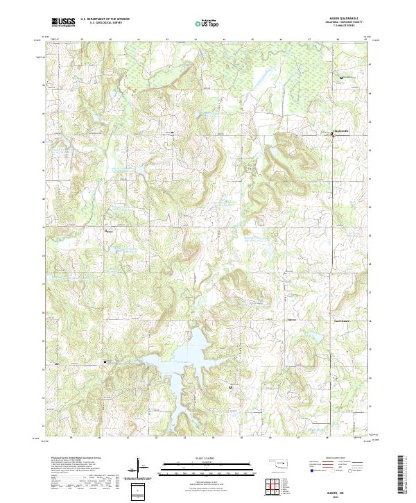
2022 Map of Mason
USGS Topo · Published 2022About this map
Okemah Lake and its northern tributaries define the landscape of this portion of Okfuskee County, where the sprawling reservoir meets the Deep Fork river system. The settlement of Mason serves as a central hub, surrounded by a high density of small water management projects such as the Okfuskee Tributary Site W-3 Reservoir and Okfuskee Tributaries Site B-4 Reservoir. These numerous impoundments illustrate the region's 20th-century focus on flood control and water storage for agricultural stability.
Find a feature on this map
51 named features on this map. Tap any name to fly to it.
Don’t see what you’re looking for? This feature index may not catch every label — zoom into the map to look around manually.
Map Details
Editions of this 2022 Mason Map
This is the sole edition of this map. No revisions or reprints were ever made.
Other maps of this area

1900 · Wewoka
USGS Topo · 1:125,000

1901 · Nuyaka
USGS Topo · 1:125,000

1954 · Oklahoma City
USGS Topo · 1:250,000

1957 · Oklahoma City
USGS Topo · 1:250,000

1963 · Oklahoma City
USGS Topo · 1:250,000

1967 · Okemah
USGS Topo · 1:24,000

1967 · Boley
USGS Topo · 1:24,000
1967 · Clearview
USGS Topo · 1:24,000
1973 · Nuyaka
USGS Topo · 1:24,000
1973 · Newby
USGS Topo · 1:24,000