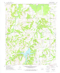
1973 Map of Mason
USGS Topo · Published 1976About this map
The Deep Fork river winds through the northern reaches of this Okfuskee County landscape, where the mid-1970s topography reveals a region deeply shaped by the petroleum industry. Scattered Oil Wells and broad Oil Field designations highlight the economic drivers of the era, contrasting with the recreational development at Okemah Lake. This reservoir serves as a central landmark, complete with a Picnic Area, Campgrounds, and a Trailer Park along its southern shores.
Find a feature on this map
30 named features on this map. Tap any name to fly to it.
Don’t see what you’re looking for? This feature index may not catch every label — zoom into the map to look around manually.
Map Details
Editions of this 1973 Mason Map
This is the sole edition of this map. No revisions or reprints were ever made.
Other maps of this area

1900 · Wewoka
USGS Topo · 1:125,000

1901 · Nuyaka
USGS Topo · 1:125,000

1954 · Oklahoma City
USGS Topo · 1:250,000

1957 · Oklahoma City
USGS Topo · 1:250,000

1963 · Oklahoma City
USGS Topo · 1:250,000

1967 · Okemah
USGS Topo · 1:24,000

1967 · Boley
USGS Topo · 1:24,000
1967 · Clearview
USGS Topo · 1:24,000
1973 · Nuyaka
USGS Topo · 1:24,000
1973 · Newby
USGS Topo · 1:24,000