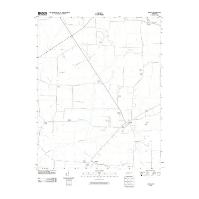
2010 Map of Mason
USGS Topo · Published 2010About this map
The town of Mason serves as the central hub of this West Tennessee landscape, situated at the intersection of several primary local routes including Charleston-Mason Rd. The area is characterized by a high density of rural burial grounds, such as Douglas Chapel Cemetery, Salem Cemetery, and Ebenezer Cemetery, which often indicate the sites of early family settlements and vanished congregation centers. To the north, the small community of Charleston sits near the Tipton County line, while Braden occupies the southern reaches near the Douglas Chapel Cemetery. The terrain is defined by the winding course of East Beaver Creek and the low-lying Baxter Bottom. Significant local infrastructure, including the Mason Post Office, highlights the continued importance of these small municipalities as centers of community life in a region predominantly shaped by agricultural land divisions and traditional homesteads.
Find a feature on this map
54 named features on this map. Tap any name to fly to it.
Don’t see what you’re looking for? This feature index may not catch every label — zoom into the map to look around manually.
Map Details
Editions of this 2010 Mason Map
This is the sole edition of this map. No revisions or reprints were ever made.
Other maps of this area

1952 · Stanton
USGS Topo · 1:24,000

1952 · Lambert
USGS Topo · 1:24,000

1952 · Stanton
USGS Topo · 1:62,500

1954 · Mason
USGS Topo · 1:62,500

1956 · Blytheville
USGS Topo · 1:250,000

1959 · Blytheville
USGS Topo · 1:250,000

1961 · Rialto
USGS Topo · 1:62,500

1962 · Rialto
USGS Topo · 1:62,500
1964 · Turnpike
USGS Topo · 1:24,000

1965 · Brighton
USGS Topo · 1:24,000