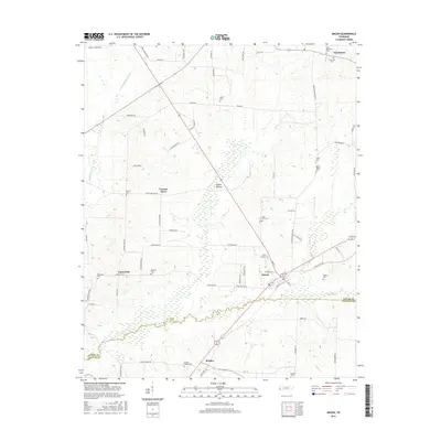
2016 Map of Mason
USGS Topo · Published 2016About this map
The town of Mason serves as a central hub on this 2016 survey, situated near the boundary line of Tipton Co and Fayette Co. This landscape is defined by an extensive network of water management features, including the Little Beaver Cr Canal, Middle Beaver Cr Canal, and Beaver Cr Canal, which drain the low-lying Baxter Bottom for agricultural use.
Find a feature on this map
75 named features on this map. Tap any name to fly to it.
Don’t see what you’re looking for? This feature index may not catch every label — zoom into the map to look around manually.
Map Details
Editions of this 2016 Mason Map
This is the sole edition of this map. No revisions or reprints were ever made.
Other maps of this area

1952 · Stanton
USGS Topo · 1:24,000

1952 · Lambert
USGS Topo · 1:24,000

1952 · Stanton
USGS Topo · 1:62,500

1954 · Mason
USGS Topo · 1:62,500

1956 · Blytheville
USGS Topo · 1:250,000

1959 · Blytheville
USGS Topo · 1:250,000

1961 · Rialto
USGS Topo · 1:62,500

1962 · Rialto
USGS Topo · 1:62,500
1964 · Turnpike
USGS Topo · 1:24,000

1965 · Brighton
USGS Topo · 1:24,000